

The River Camel rises on the edge of Bodmin Moor and runs roughly 48 kilometres north-west through North Cornwall to meet the Atlantic between Stepper Point and Pentire Point. The wider catchment covers around 413 square kilometres and drains much of the northern half of the county. It is the second-longest river wholly within Cornwall, and one of the few safe natural harbours on the north Cornish coast.
The Camel is a Special Area of Conservation, a Site of Special Scientific Interest, and a nutrient-sensitive catchment for phosphorus. Cornwall Council has been unable to approve most new residential developments in the catchment since Spring 2021, when Natural England wrote to the authority advising that the river’s protected habitats were in unfavourable condition due to excessive phosphate loading. That constraint has been partially updated, but it has not gone away. Understanding why the Camel carries the protection it does is central to understanding why nutrient credit work matters here.
What the River Camel is
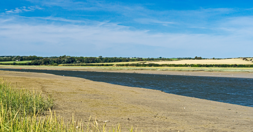
The Camel drains a catchment predominantly composed of Devonian slate and granite, with some shales and sandstones. Its source sits at around 218 metres above sea level on Hendraburnick Down. The upper reaches are moorland, giving way to woodland and farmland as the river descends. Around 65% of the catchment is grassland, with a further 15% arable land and 13% woodland. The river is tidal upstream to Egloshayle, and the estuary between Wadebridge and Padstow sits within the Cornwall Area of Outstanding Natural Beauty.
The name itself is Cornish: Dowr Kammel, meaning “crooked water,” a reference to the river’s winding course. Historically, the river was divided into three named stretches. The estuary up to Egloshayle was called the Heyl. The section between Egloshayle and Trecarne was the Allen (Dowr Alen, “shining river”). Only the upper stretch, from Trecarne to the source, carried the name Camel.
Several tributaries feed the main river, including the River Allen, the De Lank, the Ruthern, and the Stannon Brook. The River Camel Valley and Tributaries SSSI covers much of the valley between Egloshayle and Blisland and extends into the upper reaches and onto the Allen.
Why it is protected
The Camel was designated a Special Area of Conservation under the Habitats Directive, which gives it the highest level of habitat protection available under UK law. The designated area covers 604.7 hectares of the river corridor.
The SAC’s primary designation features are two species, not a habitat type. This makes the Camel unusual among England’s protected river systems, where many SACs are designated primarily for their plant communities or habitat structure.
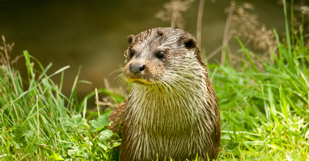
European otter (Lutra lutra) is the first primary reason for designation. The JNCC SAC citation describes the Camel as representing the otter “in its main stronghold in England in the south-west of the country.” Surveys have indicated a dense population along the river, and records show that Camel otters persisted even during the period when the species was in serious decline across most of England. The Camel population acted as a nucleus for the recolonisation of other parts of the country. The wooded lower reaches of the river provide habitat for resting and breeding, and the range of upland and lowland conditions across the catchment supports an adequate food supply throughout the year.
Bullhead (Cottus gobio) is the second primary reason for designation. The Camel represents the bullhead at the extreme south-west of its range in England. The clean, fast-flowing, relatively nutrient-poor waters with stony substrates are well suited to the species, which forms an important part of the total fish biomass in the river.
Atlantic salmon (Salmo salar) is listed as a qualifying feature but is not a primary reason for site selection. Salmon spawn in the main river channel and lower tributaries, and the Camel has historically supported one of Cornwall’s most important salmon fisheries. In December 2024, the Environment Agency introduced new byelaws prohibiting the use of fixed engines and draft nets for salmon fishing in the Camel catchment, reflecting the wider decline in Atlantic salmon stocks across south-west England.
Three Annex I habitats are also present as qualifying features: European dry heaths, old sessile oak woods, and alluvial forests with alder and ash. None are listed as a primary reason for site selection.
Cornwall’s relationship with this river
The Camel is not just ecologically significant. It runs through the middle of Cornwall’s identity.
The medieval bridge at Wadebridge, known locally as the “Bridge on Wool,” was begun in 1468 and completed in 1485. It was one of the first crossings of the lower Camel and remains one of the most listed bridge structures in the county. The river and its tributaries carry more listed bridges than any other river in Cornwall.
The Camel Trail, an 18-mile shared path following the trackbed of two disused railway lines, is one of Cornwall’s most visited attractions. Around 400,000 people use it annually, generating an estimated £3 million for the local economy. The trail runs from Wenfordbridge through Bodmin and Wadebridge to Padstow, following the river through sessile oak woodland, past salt marsh, and along the estuary. The estuary itself, with its characteristic Doom Bar sandbank, connects to Padstow, which draws approximately 500,000 day visitors per year.
John Betjeman wrote about the Camel Valley and the railway journey through it. The Camel Valley vineyard, one of England’s most awarded wine producers, takes its name from the river. The valley’s cultural weight is inseparable from its ecological condition: the otters, the salmon, the oak woodland, and the water quality that supports them are part of what makes the Camel what it is.
What’s gone wrong
Phosphate pollution.
Natural England assessed the River Camel’s SAC features as being in unfavourable condition, with phosphorus levels exceeding conservation targets. The sources are a familiar combination: agricultural runoff from the predominantly pastoral catchment, effluent from wastewater treatment works, and discharges from private septic tanks and other non-mains drainage.
In Spring 2021, Natural England wrote to Cornwall Council advising that the river was at risk from eutrophication caused by excessive phosphates, and that existing mitigation measures, including improvements to some sewage treatment and catchment-sensitive farming advice, “will not reduce phosphate levels sufficiently to restore the condition of the SAC features.” Cornwall Council paused decision-making on most residential planning applications in the catchment.
That pause has been partially revised. In February 2026, Natural England updated the nutrient neutrality rules for the Camel, revising the catchment boundary and removing the requirement for developments draining to certain wastewater treatment works (Blisland, Bodmin, Nanstallon, Bodmin Scarletts Well, and St Breward) where South West Water upgrade commitments are considered sufficient. The revision has not been universally welcomed. Helland Parish Council publicly criticised the change, citing 791 hours of sewage outflow from the Nanstallon works alone in 2024.
For the remaining catchment area, the nutrient neutrality requirement remains in effect. Developers need to demonstrate that new residential development will not add to the phosphate burden on the SAC. That means either achieving neutrality on-site or purchasing phosphate credits from a verified mitigation scheme.
How nutrient credits work in the Camel
Cornwall Council has been developing its own phosphate mitigation programme with ‘Royal HaskoningDHV’, including constructed wetlands downstream from wastewater treatment works and a septic tank replacement programme for homeowners. Nature-based temporary credits, delivered in partnership with Westcountry Rivers Trust, are also part of the council’s strategy. Cornwall Council has indicated it will prioritise affordable housing, small developers, and community-led schemes when issuing credits.
South West Water is required to upgrade the Nanstallon, Scarletts Well, and Camelford wastewater treatment works to meet specified nutrient removal standards by 1 April 2030. Cornwall Council’s phosphate calculator (version 4, updated December 2025) factors in those planned upgrades.
The core mechanism remains the same across all 27 nutrient-affected catchments in England. Each septic tank that gets replaced with a modern package treatment plant removes a measurable quantity of phosphorus from the catchment. That reduction can be quantified, verified, and secured through a Conservation Covenant, creating a credit that a developer can purchase to offset the nutrient load of a new development. The credit is specific to the Camel catchment. It cannot be transferred to another river system.
NRC’s model operates on this principle nationally. Where NRC works within a catchment, each installation is backed by a Conservation Covenant with RSK Biocensus as the Responsible Body under the Environment Act 2021. The covenant is legally binding on the land, independently enforced, and runs beyond ownership changes. It removes the long-term compliance burden from both the homeowner and the local planning authority.
What this means for developers in the Camel catchment
The planning constraint in the Camel is real and ongoing. Not every part of the catchment is affected following the February 2026 boundary revision, but for developments that do fall within the revised catchment area, the nutrient neutrality requirement applies.
Developers who need phosphate credits to proceed with applications in the Camel can check their position through NRC’s Developer Portal.
The Camel is Cornwall’s river. The otters that held on here when the species was disappearing across England, the salmon that still return to spawn, the bullhead in the clean headwaters, and the valley that 400,000 people walk and cycle through every year all depend on the same thing: water quality. Nutrient credit work is one part of the answer. It is a measurable, verifiable, enforceable part.